
Start With a Milpitas Street Address
A street search works best as a chain of address records. Begin with the exact number and street name, not a guessed person. The county assessor can find a parcel by situs address or APN. SCCMap can show the parcel boundary and adjoining lots. A deed search can then use an APN, owner name, document number, or book and page at the county office. Building records add project dates and applicants. A reverse directory can add the name printed beside a house number in a particular year.
That chain yields different kinds of evidence. A parcel is land. A deed is a recorded transaction. A permit is a project record. A directory is a publication snapshot. A voter file, when accessed through an approved route, is a controlled registration record. No step turns the address trail into a complete list of current occupants.
- Normalize the address and run the Santa Clara Assessor Property Search by Street Number and Street Name, or by APN.
- Save the APN, situs address, legal map reference, and any mailing-versus-situs distinction shown by the result.
- Open SCCMap, locate the parcel, and click adjoining lots to understand the street and block geometry.
- Take the APN or a recorded party name to the Clerk-Recorder terminal and collect document number, date, role, and legal description.
- Use Milpitas ApplicationXtender for address or permit-number files, then consult the 1914-forward reverse directory shelf for historical occupants.
When the goal changes from a whole street to one person, the Milpitas resident lookup page provides a separate identity workflow. The address trail should remain the spine.
Normalize a Milpitas Address for APN Search
Santa Clara's address gateway treats a street address as a situs location. Try the street number and street name without a suffix when the first search fails. The advanced form makes Street Number required, Street Name required, City required, and Direction, Street Type, and Unit optional. The APN form accepts an eight-digit number or a hyphenated form. Every mode requires acceptance of the portal terms.
Keep the original spelling beside the normalized version. A unit, direction, subdivision label, or old route name may be the difference between a result and a blank screen. Preserve the APN even when a street number later changes. The APN is an assessment key, not the legal description itself, and a parcel split or merger can change the indexing path.
| Search field | Type and use | Research note |
|---|---|---|
| Street Number | Text; numeric situs number | Required in advanced address mode. |
| Street Direction | Optional selection | Use only when the address supplies a direction. |
| Street Name | Text; street name | Required in advanced address mode. |
| Street Type | Optional selection | Do not guess a suffix when the source is unclear. |
| Unit | Optional text | Useful for multi-unit records when the portal recognizes it. |
| City | Text; city selection | Use Milpitas, then verify the incorporated boundary separately. |
| APN Number | Alternative text field | Accepts eight digits or a 123-45-678 style form. |
The official address-to-APN gateway explains the search's address focus. It is a better first key than trying to guess a web owner-name directory.
Browse Milpitas Parcels in SCCMap
Once the APN is known, SCCMap turns a single result into a street view. Search or locate the address, zoom until parcel lines and APN labels are readable, select the target, and note the jurisdiction and map context. The viewer offers search, layers and legend, pan, zoom, identify or select, measure, and print or share tools, although labels can change with a viewer update. The selected parcel can link to assessor information, but owner and tax details may require the separate assessor record.
For a block walk, click each touching parcel and record its APN. A right-of-way, common parcel, or multi-unit tract may look like a neighbor but represent a different land unit. A measure tool can describe distance. It cannot prove a social relationship or who occupies a building.
The Santa Clara Assessor address search is shown below. Its parcel focus helps the Milpitas street directory stay tied to an actual land unit rather than a postal label alone.
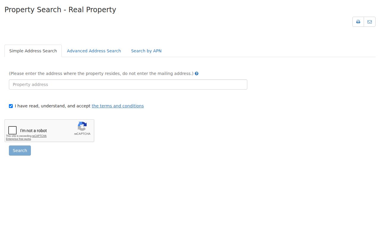
Use the map for parcel context, then return to the address record for the fields that can be cited and dated.
Which Milpitas Records Follow an Address?
Address-keyed records can be walked parcel by parcel, but their coverage and proof differ. The table below keeps the roles separate. It also shows why an address chain is a workflow rather than one all-purpose database.
| Record set | Keeper | What it shows | Access |
|---|---|---|---|
| Assessor parcel | Santa Clara Assessor | APN, situs, property facts, mailing route | Free address/APN portal |
| SCCMap parcel | Santa Clara GIS | Boundaries, adjoining lots, public map layers | Free interactive viewer |
| Deed and lien index | Clerk-Recorder | Recorded parties, dates, documents, legal descriptions | Office terminal and Digital Reel |
| Building permit file | City of Milpitas | Project dates, applicants, owner fields, inspections | Online, City Hall, microfilm, request |
| Reverse directory | History San José or California Room | Published occupant or subscriber by street and number | Reference collection, 1914 forward |
| Voter file | State and county elections | Registered voters only under controlled access | Authenticated or approved request |
The parcel number links assessor, map, permit, and recorder work. The street name links the parcel to a historical directory. The date links a directory listing to a deed, newspaper, or census clue. Keep those links in notes so a later reader can see which record supports which statement.
Assessor Fields Behind the Street Directory
The public assessor web service is address and APN keyed because California Government Code §6254.21 restricts internet publication of certain protected owner information. A parcel result may include tax-rate area, property type or use, assessed land and improvement values, exemptions, roll year, map links, and a tax-mailing address. The situs address is the physical parcel. The mailing address is where tax correspondence goes. They may match, but a match still does not prove occupancy.
When an address returns several units or a common parcel, keep every result and its unit note. Do not flatten a multi-unit property into one name. The assessor's disclaimer and current terms govern what the web display releases. For details the web view suppresses, use the lawful channel described by the custodian rather than inferring a hidden name.
The official address-to-APN gateway is represented below. Its fields make the address-first design visible.
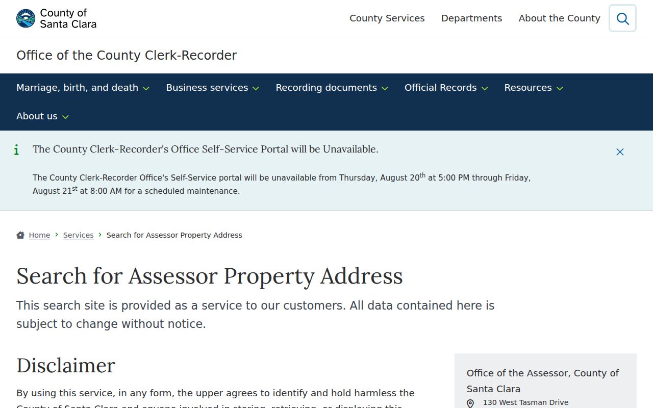
A good street entry records the search date, exact input, returned APN, situs, and map reference. That small audit trail prevents a later address change from being mistaken for a new parcel.
Take a Milpitas APN to the Recorder
The Clerk-Recorder's remote grantor-grantee index ended in 2018. For a Milpitas deed chain, visit 110 W. Tasman Drive in San Jose with an APN, current owner or seller name, document number, document date, or a pre-1994 book and page reference. The office describes 1850 to present recorded coverage. The Digital Reel holds the 1850 to 1980 index, while 1981 forward uses public workstations.
At the terminal, search by APN, grantor, grantee, document class, or combined party. A grantor is the party conveying an interest. A grantee is the party receiving it. Record the role, date, document number, type, legal description, and map reference. Then search the earlier seller as a grantee to step backward. Staff do not conduct title searches, so arrive with a short list and do the comparison yourself.
Copies can be requested in person, by email to bus-rdc@rec.sccgov.org, or by mail when the instrument or book/page key is known. The published research describes $4 for the first page, $2 for each additional page, $2 certification per document, possible card surcharges, a seven-business-day processing period, and no electronic delivery. Confirm the current fee page before ordering.
Milpitas Permit Dates by Address
Building records give the address chain a project timeline. In ApplicationXtender, select BLDG1, choose New Query, and search by address or permit number. The permit archive also has City Hall access and older microfilm. Email BuildingPermitCenter@milpitas.gov when a file requires a research request; staff target ten days and may ask for more time when the location or volume is large.
Permit applications, plan-check comments, inspections, structural calculations, soils material, Title 24 documents, code correspondence, photographs, and legal documents are identified as permanent records in the retention material. Copyrighted plans and calculations may need architect or engineer authorization. Applicants and design professionals are project participants, not automatic occupants.
The Milpitas Record Research instructions accompany the permit image below. The BLDG1 search tip is the kind of local detail that makes this street directory useful when a broad web search fails.
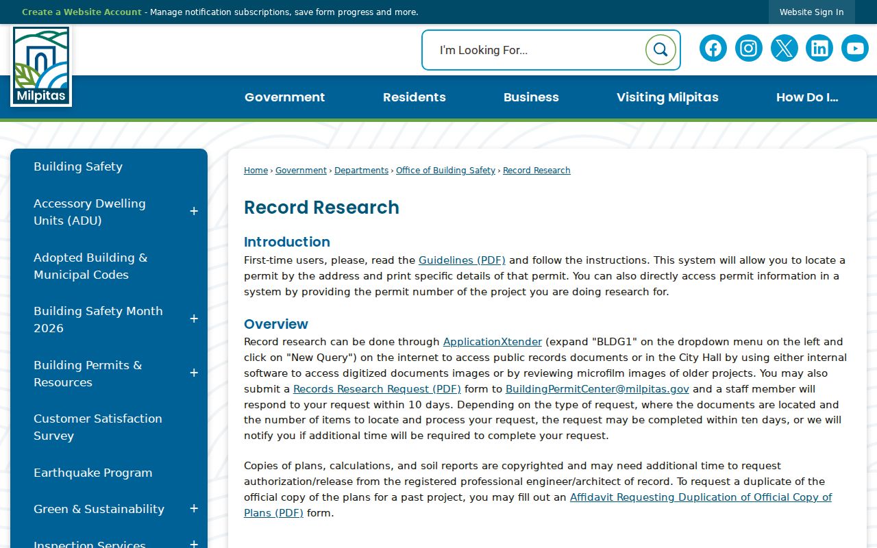
Use a permit date to frame a deed, newspaper, or directory search. It can show when a structure changed, not who lived there every year.
Read a Milpitas Street in Reverse Directories
History San José's city-directory collection runs from 1870 through 1979 and adds a reverse street-address index in 1914. A reverse or criss-cross directory orders streets, then house numbers, with the published occupant or business beside the address. The California Room holds the same broad city-directory series. The exact inclusion of Milpitas varies by edition, so check each volume's coverage statement.
Telephone books extend the county run from 1905 through 2018. The February 1971 Library of Congress scan includes Milpitas and prints the locality as “Milpts,” a useful OCR search term. A listing may show a surname, given name or initials, spouse notation, street number, phone number, and sometimes occupation or employer in a Polk-style volume. A subscriber is not necessarily the owner.
- Parcel
- The land unit indexed by the APN and mapped in SCCMap.
- Situs address
- The physical location assigned to the parcel, distinct from a tax mailing address.
- Plat
- A recorded subdivision map that can tie lots and blocks to older descriptions.
- Criss-cross directory
- A reverse address section that turns a street and number into a dated published name clue.
Copy the entry exactly, including abbreviations. Compare it with the deed date and a Milpitas Post notice. The historical shelf belongs to the Milpitas city directories page; the street page uses only the address method that fits current research.
Mailing and Situs Addresses in Milpitas
Milpitas sits at the Santa Clara and Alameda county edge, and postal city, service district, county, and incorporated city are not interchangeable. A 95035 mailing label can be a strong clue, but the parcel still needs a GIS and situs check. A tax mailing address can be outside the parcel. A legal description can remain stable while the street name or number changes.
The USPS lookup is useful for standardized delivery information. It does not certify a city's legal boundary. The image below comes from the USPS city and state ZIP lookup. Verify the delivery result, then compare it with SCCMap and the assessor record.
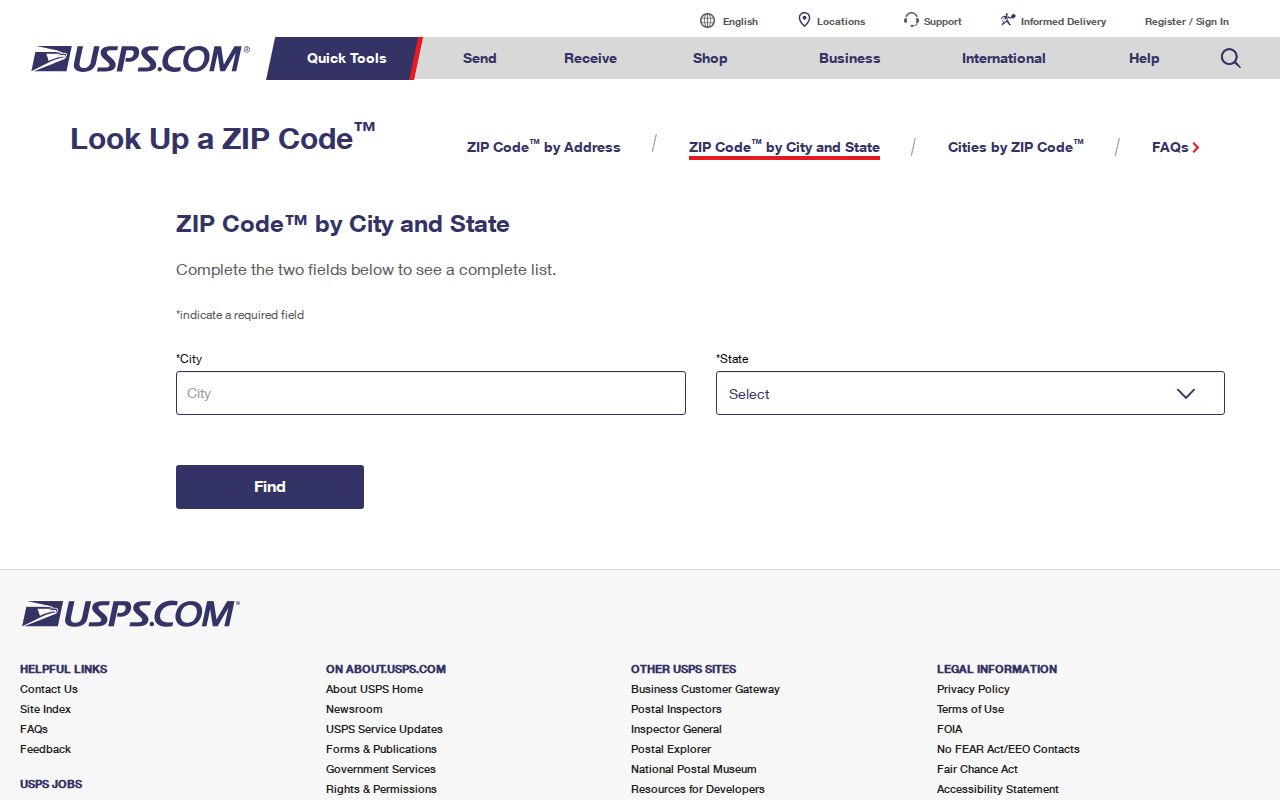
This two-tool check avoids placing a postal address in the wrong city record system. ZIP-versus-city questions stay separate from the street chain, while the address record remains the primary key.
Why Milpitas Voter Search Stops
California My Voter Status authenticates one person with a name, birth date, county, and additional identity detail. It can return that voter's status, address, party preference, precinct, district, and election information. It cannot be used as a public whole-street search. Controlled voter-file extracts require an approved purpose, applicant identity, security terms, fee, and the restrictions in Elections Code §2194.
Do not fill a street directory gap with a voter guess. Nonvoters, people whose information is protected, people registered elsewhere, and people who recently moved will not map cleanly to the parcels. Use the elections office for an authorized request, and keep the purpose and scope precise.
Street Names and Milpitas Legal Descriptions
Modern addresses can be younger than the land. Milpitas grew from ranch and agricultural routes into a postwar city, and rapid subdivision development means a deed may use a lot, block, map, or rural description that does not resemble the current street line. The research did not locate an authoritative citywide street-renumbering year. Do not invent one. Resolve an uncertain address through the parcel map, legal description, permit file, planning archive, or the library's in-house maps and guides.
Save the subdivision, lot and block, APN lineage, document number, and any old street wording. Those keys bridge a directory entry to a deed and help separate a moved structure from a new parcel. If a current name does not appear in an old volume, consider a coverage gap, a different locality label, a missed canvass, a private phone listing, or an abbreviation such as “Milpts.” Absence is not proof of absence.
Limits of the Milpitas Street Record
Other occupants, household members, utilities, delivery accounts, DMV addresses, and protected official addresses are not comprehensive public street records. A deed names recorded interests. A property roll identifies parcel facts. A directory captures a publication year. Even a matched owner mailing address only suggests a connection to the property. The current resident may be different, unlisted, or protected.
Lawful use. Milpitas address and parcel records may support personal, lawful research, family history, property curiosity, or civic work. Never use a name or address to stalk, harass, intimidate, or harm anyone.
For a record that is not online, use the custodian's counter, request form, mail route, library reference desk, or archives instructions. A focused California Public Records Act request can seek existing municipal records, but exemptions and confidentiality rules remain. A responsible Milpitas street directory states the limit beside the lead, then offers the next lawful record path.